

AACo - Natural Capital Vegetation Assessment - Northern Supply Group.
Australian Agricultural Company (AACo).
Vegetation Asset Account.
Environmental Account ID: AU00099
Account Holder: Australian Agricultural Company (AACo)
Purpose: Document the condition of the native vegetation, to inform sustainable management of the 5 properties, and to communicate environmental outcomes for internal and external purposes
Current land use: Grazing
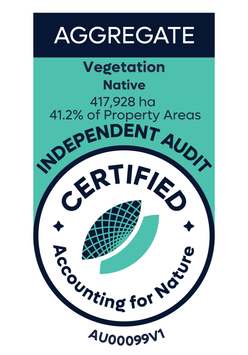
Environmental Asset: Vegetation - Native
Asset Account ID: AU00099V1
Registration date: 04 April 2025
Baseline Certification date: 18 May 2026
Certification pathway: Independent Audit (reasonable assurance)
Asset Account area: 417,918 ha (41.2% of total aggregate property area)
Method: AfN-METHOD-V-10
Asset Account snapshot.
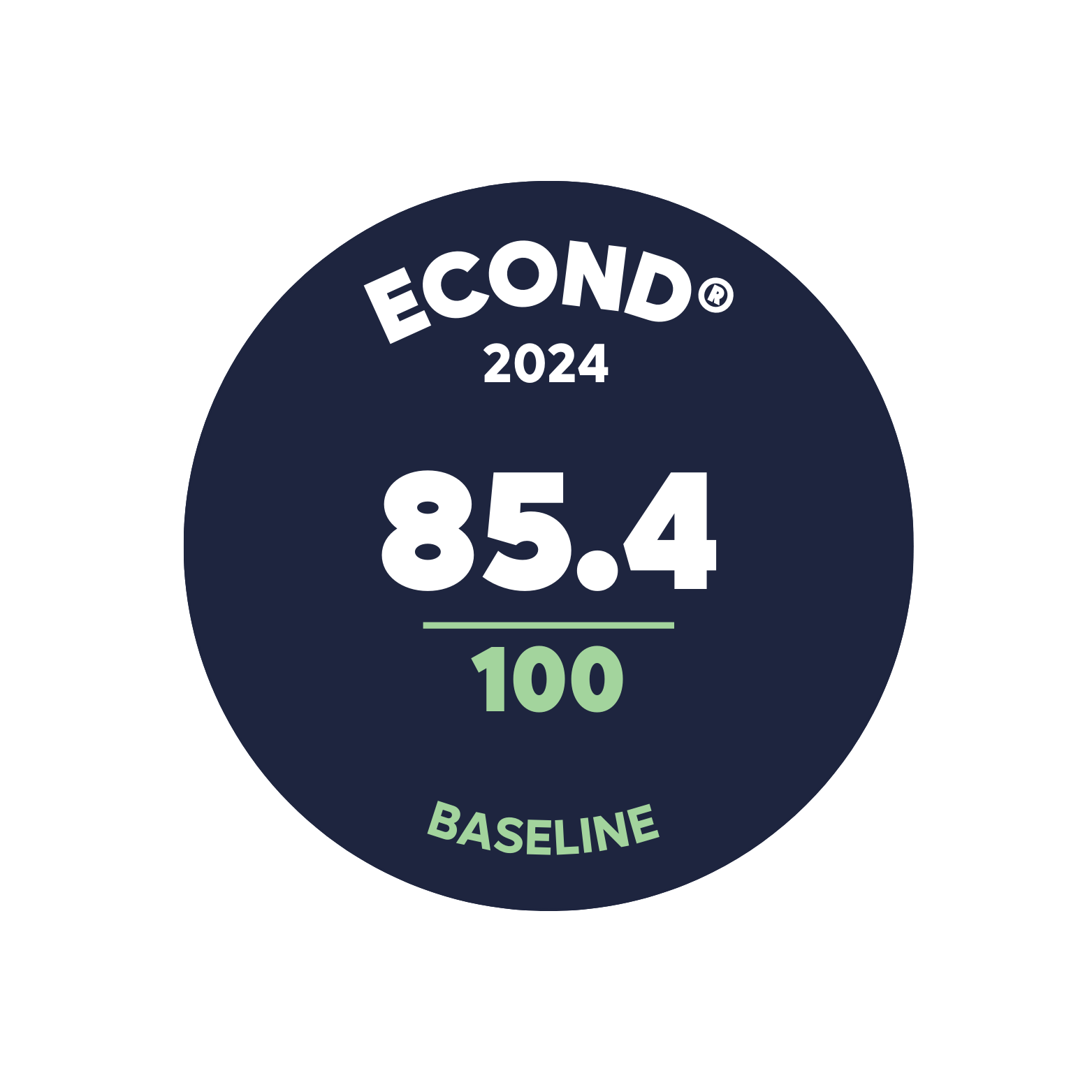

Asset Account Econd® summary.

Asset Account statement.
-
04 April 2025 - Registration Date
-
18 May 2026 - Certification Date
Significant outcomes.
The stratification and assessment of vegetation across the Northern Supply Group properties covers over 1.01 million hectares of various Eucalypt woodlands, alluvial plains, and creeklines. The assessment resulted in the identification and delineation of 417,928 hectares of Tier 1 Broad Vegetation Types (BVTs), with some areas also classified as Tier 2 or Tier 3. This broad vegetation mapping, based on a field-validated classification with a 97% accuracy rate, forms the foundation of the sub-asset and assessment unit accounts, highlighting the ecological significance of the region.
The properties are generally similar in condition, subject to land management practices noted within each assessment unit. The highest sub-asset Econd® score was recorded in Bloodwood/Eucalypt woodlands on basalt (90.2), while the lowest was observed in Melaleuca forest (74.5). The overall Asset Econd® is 85.4.
Limitations & disclosures.
Limitations In tree and shrub model.
While the model used to segment the crowns of woody plants was generally effective, there were some environments where it was unable to effectively capture these plants, and low shrubs were not adequately detected. These include some of the river systems and water courses and Alluvial Plains/Creekline Woodlands/Herblands sub-assets. This limitation may have led to under-estimation of total canopy and shrub cover scores at some sites.
Insufficient area of target vegetation class covered.
Three of the drone plots analysed covered a total target vegetation class of below the required 5-hectares (Table 11). This was the result of erroneous flight planning, where the Incorrect vegetation was measured. Nevertheless, the assessment of these slightly smaller areas Is expected to produce reasonable results, and results from these sites were not removed from the final analysis.
The K and L indicators were merged to match the approach taken by BioCondition
The Biocondition benchmarks did not separate between indicator K (Native species count for herbaceous species – forbs), and indicator L (Native species count for herbaceous species – other species). In order to make the observations of these indicators comparable with the Biocondition benchmarks, the ‘forbs’ and ‘other species’ were merged for the calculation of indicator condition scores for Northern Territory. The original information of these two indicators has been preserved, so future assessment could separate them if more detailed benchmarks were made available. For the NT for indication
Calculation of native tree species recruitment
While the Method recommends the use of a formula comparing the benchmark cover for recruitment to the observation, this approach was not deemed appropriate – as the translation of drone derived data did not accurately relate to the field derived benchmarks. As a result, recruitment was calculated as follows: when canopy trees were present, the presence of recruits within field data earned a score of 100, and the absence of recruits led to a score of zero. As more relevant benchmarks are made available, the incorporation of more sensitive recruitment measures will be considered.
Native tree size structure was excluded from the account
The accurate measurement of tree size structure against a benchmark was not deemed feasible. As more detailed benchmarks and individual tree segmentation/classification approaches are made available, this indicator can be revisited for follow-up accounts.
Coarse woody debris calculation
An automatic approach to calculating the length of coarse woody debris was not feasible. As an alternative, this indicator was calculated by digitising (using a line draw tool in Drone-Deploy) all of the visible coarse woody debris within 0.1-hectare sub-plots for each of the sites. The length of each of the lines was then summed, and multiplied by 10, to provide an estimate of the length of coarse woody debris per hectare.
Cryptogam was excluded from the account
Because benchmark data for cryptogam cover was not available, including within the BioCondition datasets, this indicator was excluded from this account. As with the merging of indicators K and L, the observations of cryptogam have been preserved and could be calculated later if benchmarks for this indicator were made available.
Last update: 19 May 2026


Environmental Account.
Learn more about the Environmental Account.