

WWF Koala Friendly Carbon Initiative Pilot 1.
World Wide Fund for Nature Australia (WWF-Au).
Koala Habitat and Population Asset Account.
Environmental Account: AU00090
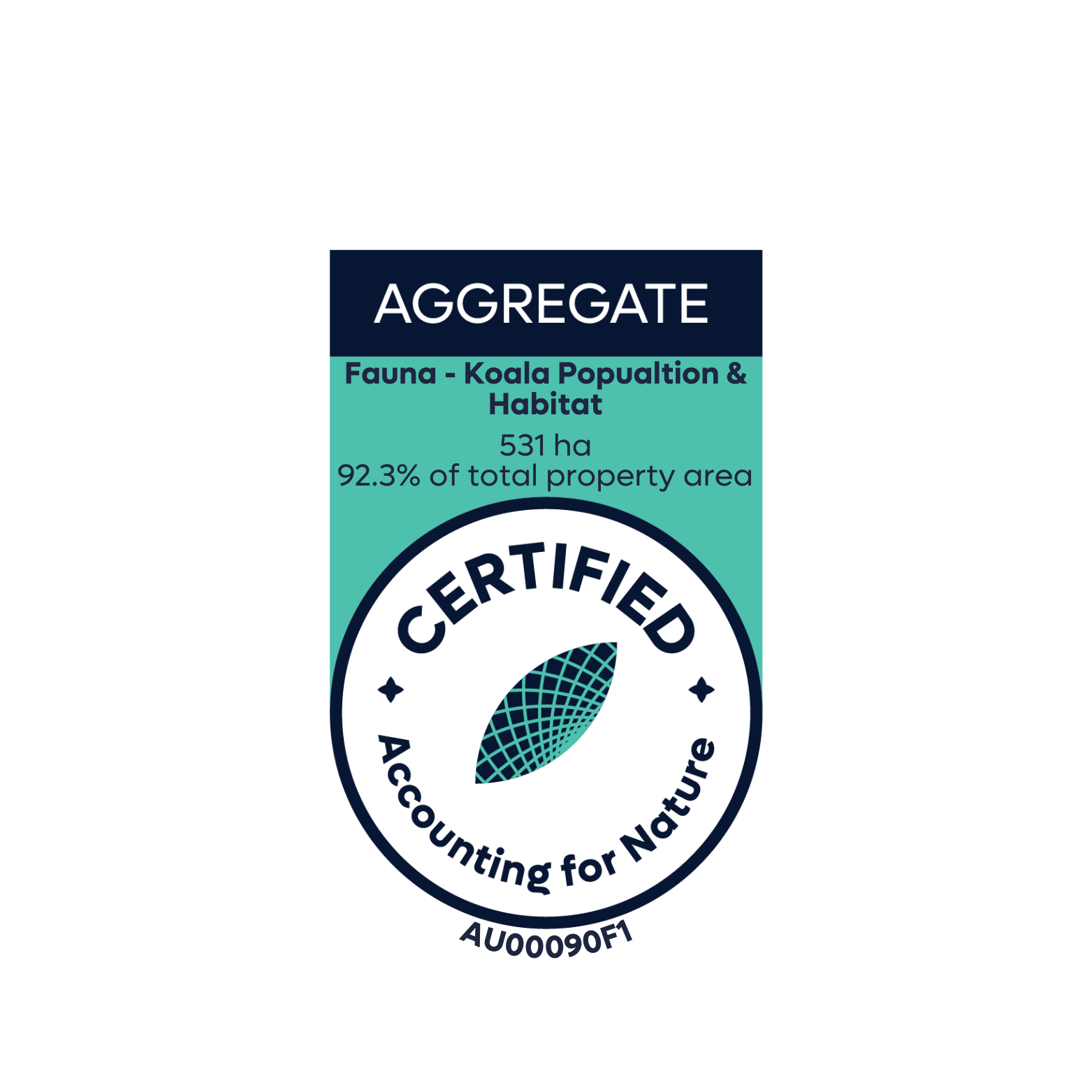
Environmental Asset: Fauna - Koala Population & Habitat Condition
Asset Account ID: AU00090F1
Registration date: 27 February 2025
Certification date: 02 December 2025
Certification pathway: AfN Verified
Purpose: To reliably measure and track the changes in condition of koala habitat and population.
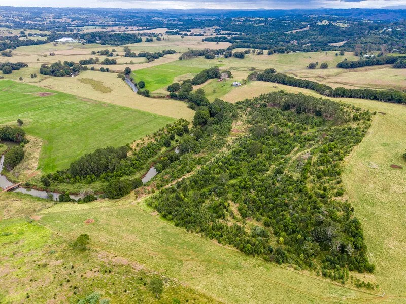
Current land use: Grazing & conservation.
Area: 531 ha
Method: AfN-METHOD-F-04
Fauna Asset Account.
Environmental Account ID: AU00090
Account Holder: World Wide Fund for Nature Australia (WWF-Au)
Purpose: To reliably measure and track the changes in condition of koala habitat and population
Current land use: Grazing and conservation
Environmental Asset: Fauna - Koala Population and Habitat
Asset Account ID: AU00090F1
Registration date: 27 February 2025
Baseline Certification date: 02 December 2025
Certification pathway: AfN-Verified
Accredited Expert/s: Renee Rossini
Asset Account area: 531 ha (92.3% of aggregated property area)
Method: AfN-METHOD-F-04
Asset Account snapshot.


Asset Account Econd® summary.
Asset Account statement.
-
27 February 2025 - Registration date
02 December 2025- Certification date
Significant outcomes.
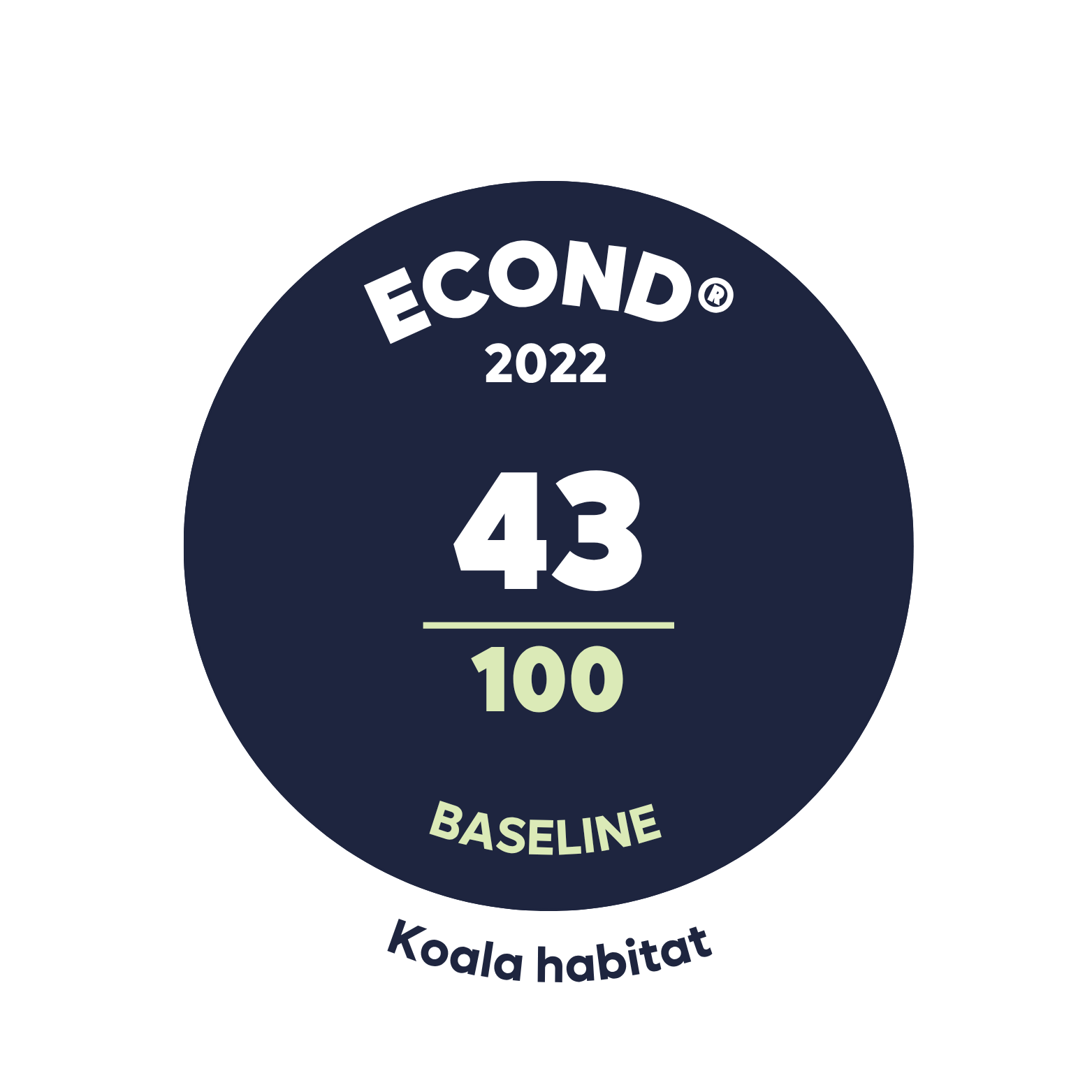
The calculated Econd® for this environmental account:
· Component A Koala population is 1.
· Component B Koala habitat condition is 43.
Despite the low occurrence of observed koala scat across the accounting area, there were scratches found on many trees within the sample sites, although, without the presence of scat, this is not considered conclusive evidence of activity and is not recorded as such. The results found koala activity to occur in the vegetation sub-asset only, which is not surprising, due to the low condition of the cleared sub-assets.
In regard to the Koala Habitat condition, the best performing indicator was the prevalence of weeds, sitting at an average of 78% of the benchmark for all properties combined (Figure 7). This high percentage displays a low presence of weeds and therefore suggests good conditions across the accounting area; however, this belies different patterns across the Assessment Units and forest types. For example, no site that is unvegetated scores more than two out of five for threats from weeds. This is because these areas are currently grazed or dominated by high-biomass invasive pasture grasses, which exclude woody weed recruitment. Whilst these areas score well on weeds, they are not free of threats. The first threat in need of addressing is a lack of suitable food and shelter trees, but this is captured in other indicators.
Target condition Econd® scores of 55 and 30 for koala habitat and population, respectively, by 2047 (25 years post-planting) are based on current site conditions, knowledge of the region and its potential for change over time, and also expectations of land management practices for the projection period (25 years). The use of the Econd® framework means that each site can have a predicted target condition applied to it that reflects the realities of the site. All individual properties are expected to achieve an increase in environmental condition and improve the koala habitat quality across the site. However, ongoing land management practices will largely dictate the long-term outcomes and trajectory of environmental condition by 2047. It cannot be known how subtleties of habitat quality will change in the distant future – for example, weed condition may deteriorate as project management support reduces with the sale of all future carbon credits. Likewise, we cannot know which sites koalas may migrate into or how well they will persist. The projected condition targets are optimistic and reflect the high level of investment in these planting projects, and represent our intention for future gain.
Limitations & disclosures.
Some limitations that should be considered in interpreting this data:
Mapping of pre-colonial condition of vegetation is based on the best evidence and modelling, but we cannot know for sure what forest types were on these sites before land clearing occurred. By using a ‘high accuracy’ account, we can create some surety, as it can be said with high confidence that the landscape would have been completely covered in native forests. However, within each property, the representation of each forest type has been estimated based on the best available data.
As this account uses the ‘high accuracy’ method for measuring habitat quality, subtleties in each indicator have been reduced to assessed scores out of 5. This condenses a range of conditions into a bracket that inevitably leads to some sites of slightly varying condition receiving the same score.
The benchmark koala population for the account was developed using the Phillips and Callaghan 2011 and cross-referenced with WWF-Au SAT survey data throughout the Northern Rivers. This covers over 250km of coastline and includes 100+ individual SAT surveys in a range of habitats. We cannot know the number of koalas that occupied the Northern Rivers pre-colonisation, nor how that population would have left indirect evidence of its presence through scats and scratches on trees. The benchmark has been set with the best available knowledge but assumes that this data could represent a past condition that is unknowable.
Condition targets are estimated based on current site conditions but also consider the expected land management practices for the projection time period of 25 years. Some of the properties within the aggregation are multigenerational land holders, and land ownership is unlikely to change, whilst some are more likely to change hands during the 25-year period. Whilst land management within CEA areas cannot change significantly due to 100-year permanence obligations of the carbon project, other forested and even cleared areas may be subject to drastic land management changes that could affect the future Econd®.
The scoring system for one threat category, Weeds, is somewhat ambiguous in the method. We interpreted this indicator to be a total of five categories defined in our data collection form with the following instructions:
“Relevant weeds are any species capable of growing in a multi-stemmed, woody shrub or tangling vine habit likely to prevent or disrupt the dispersal of a koala. Weeds to be included are lantana, broadleaf privet, narrowleaf privet, tobacco, giant devil's fig, broad-leaf pepper, castor oil plant, leucaena, cockspur coral tree, balloon vine, cats claw vine. Weeds not included are: crofton, milkweed, cobblers pegs, purple top, ochna” The five categories to be chosen from are: 1 = Head high, 2 = Shoulder High, 3 = Hip High, 4 = Less than Hip High >10% cover, 5 = Less than Hip High <10% cover.Where revegetation has occurred across these properties within the aggregation, these planting works are aiming to replicate forest types that would have existed on the site prior to clearing by early settlers. Species selection for this activity was undertaken using a range of reference materials. This includes the NSW PCT database, pre-clearing mapping, local ecological knowledge and comparison with reference communities and existing remnant/regrowth vegetation on or nearby the site. Whilst this work is undertaken by highly skilled staff, there can be no assurance that the species included in the mix are exact compared to what would have been on the site prior to European settlement, but rather it is the best representation of the estimated forest based on the data available.
Environmental markets.

Australian Carbon Credit Unit (ACCU) Scheme project, registered with the Australian Clean Energy Regulator. More information can be found here:
Last update: 04 March 2026


Environmental Account.
Learn more about the Environmental Account.