

Norbrook Natural Capital.
M-Nut.
Vegetation Asset Account.
Environmental Account ID: AU00078
Account Holder: M-Nut
Purpose: Inform sustainable land management and demonstrate condition for environmental markets
Current land use: Environmental management
Environmental Asset: Vegetation - Native
Asset Account ID: AU00078V1
Registration date: 11 September 2024
Baseline Certification date: 20 June 2025
Certification pathway: AfN-Verified
Accredited Expert/s: Misty Neilson
Asset Account area: 198 ha (38.5% of property area)
Method: AfN-METHOD-V-01
Asset Account snapshot.


Asset Account Econd® summary.

Asset Account statement.
-
11 September 2024 - Registration Date
-
20 June 2025 - Certification Date
Significant outcomes.
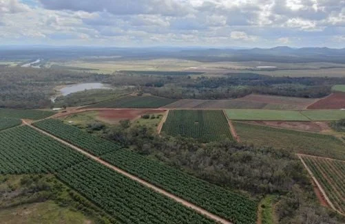
The Native Vegetation account covers 198ha, representing nearly 40% of Norbrook’s total land area, and is dedicated to conservation and enhancing natural capital value. The overall baseline Econd® score of 46.2 was significantly influenced by the conservative scoring of zero for all non-remnant areas, which make up approximately 35% of the asset account area. This baseline score was calculated using the Accounting for Nature® Framework. The remaining land, used for commercial macadamia orchards, was not included in the assessment.
Eucalypt open forests on coastal lowlands (BVG 9) had the highest Econd® score of 57.1, with assessment unit 12.5.4 (Remnant) of this sub-asset scoring an Econd® of 66.6. Eucalyptus tereticornis woodlands (BVG 16) followed closely with an Econd® score of 50.1, indicating these sub-asset ecosystems are the least disturbed.
Spotted gum open forests on undulating hills (BVG 10) scored an Econd® of 45.3, measuring as the third-highest scoring sub-asset ecosystem. Notably, the assessment unit RE 12.5.7 (Remnant) recorded the highest individual Econd® score of 74, representing nearly half of the asset account area. The overall score for this sub-asset was significantly impacted by the conservation indicator condition scores of zero assigned to the Pre-clear 12.11.6 (Non-Remnant) assessment unit.
Notophyll and mesophyll vine forests (BVG 4) scored an Econd® of 20.8, reflecting significant impacts from weed infestations and past clearing.
Areas for improvement have been identified, and their potential impact on future Econd® scores has been considered. The next assessment is scheduled for 2026, aiming to monitor natural assets, support sustainable land management, and guide ecological actions for enhanced outcomes and responsible stewardship.
Limitations & disclosures.
Vegetation mapping is a complex process involving the interpretation of field and remote sensing data. Full field verification of the account area was not feasible, meaning future surveys may reveal inaccuracies in the digital mapping. Although the assessment was undertaken by experienced ecologists, agricultural scientists, and GIS analysts, limitations in site access and data collection may have had minor impacts on accuracy.
To address this, some survey points were adjusted to ensure correct vegetation types were sampled. However, several sites were inaccessible due to weed infestations or steep terrain. In these cases, measurements for large trees, canopy height, and cover were estimated from a safe distance, introducing a degree of uncertainty. Non-native plant cover and litter indicators were conservatively scored as zero, potentially underestimating actual conditions but ensuring caution in the results.
Future restoration activities, such as weed removal, are expected to improve access and enable more accurate data collection, ultimately enhancing the reliability of the environmental account.
Small patches of regrowth were grouped with adjacent remnant vegetation to streamline fieldwork, where inspections confirmed no significant differences in overall condition. This grouping was not applied to configuration indicators like patch size and connectivity, so the impact on condition scores is minimal.
Hoop Pine (Araucaria cunninghamii), although native to Australia, is not endemic to ecosystems in this account. Due to its current land use and planned restoration activities, it was excluded from large tree, canopy height, and cover metrics, but included in the non-native plant cover assessment. This may slightly reduce condition scores but allows for future flexibility if these trees are progressively removed.
Non-remnant areas, including a Hoop Pine plantation, were stratified based on their pre-clear Broad Vegetation Groups and Regional Ecosystems, rather than grouped into a single unit. Field observations showed minimal differences in structure and diversity, particularly in areas dominated by pioneer weedy regrowth species such as Acacia leiocalyx. This approach supports adaptable future restoration and monitoring. While it may influence individual sub-asset scores, it does not affect the overall Econd® score.
For riverbank ecosystems, plot dimensions were modified to suit narrow site conditions, an adjustment permitted under the method and unlikely to affect condition scores. Canopy cover was estimated from a safe distance using a laser rangefinder, which introduces some uncertainty.
Last update: 29 January 2026


Environmental Account.
Learn more about the Environmental Account. Environmental Accounts can have one or more Asset Accounts.