

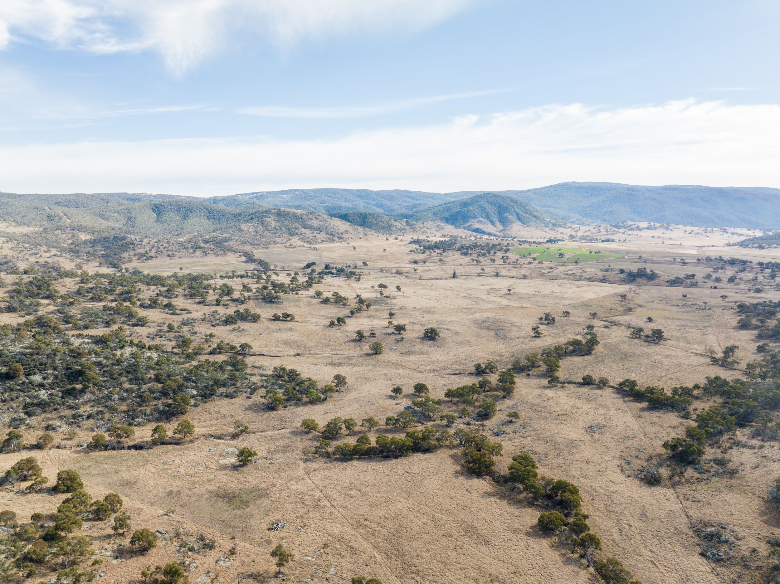
Gurrabeal Reforestation and Biodiversity.
Greenprint Nature.
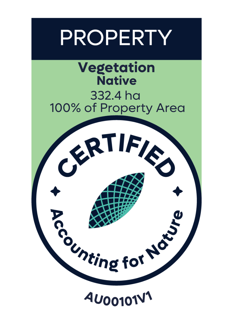
Vegetation Asset Account.
Environmental Account ID: AU00101
Account Holder: Greenprint Nature
Purpose: Provide quantitative assessment of the condition of native vegetation, prior to native planting initiative to access improvement in condition overtime.
Current land use: Environmental management and restoration
Environmental Asset: Vegetation - Native
Asset Account ID: AU00101V1
Registration date: 04 April 2025
Baseline Certification date: 23 April 2025
Certification pathway: AfN-Verified
Accredited Expert/s: Dr Matthew Taylor, Samuel Bean, Helena Bowler, Nicki Ledger, Nakita Thackwray
Asset Account area: 332.4 ha (100% of property area)
Method: AfN-METHOD-V-03
Asset Account snapshot.


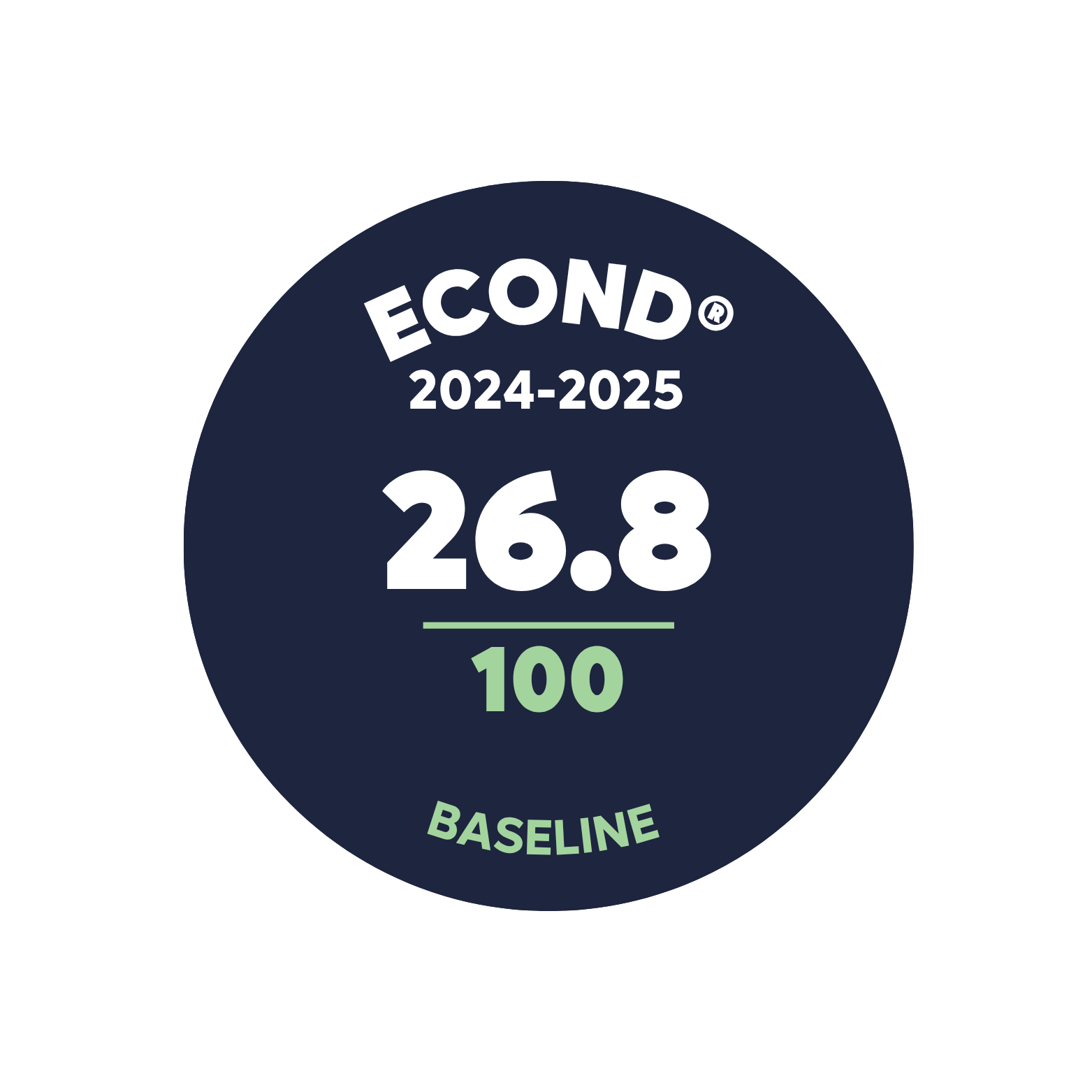
Asset Account Econd® summary.
Asset Account statement.
-
04 April 2025- Registration Date
-
23 April 2026 - Certification Date
Significant outcomes.
An Econd® of 26.8 was recorded for native vegetation, which comprises 100% of the Environmental Account area. Of the 332.4 ha Environmental Account Area, approximately 211.7 ha has been identified as cleared land and will be subject to an active program of revegetation where suitable. The goal of this is to improve the environmental condition of this cleared area, and it is planned that both this and the broader restoration activity will also lead to an improvement in the condition of the remnant vegetation areas.
Our intention is to continue to monitor and report on the condition of our environmental assets at Gurrabeal every 5 years, during autumn (to replicate baseline collation), using ecological data gained from the Environmental Account and ACCU Reforestation carbon project to guide and evaluate success of management. We are committed to ongoing, sustainable stewardship of the land and see opportunities to develop and test approaches that may be suitable for use across other sites in the future.
Limitations & disclosures.
Reference benchmark sites
Benchmark values for basal area were collected from best-on-offer reference locations, including nature reserves and travelling stock routes near the Environmental Account Area. Given the highly modified nature of the surrounding landscape, fully pristine reference sites were not available. Sites were instead selected as the most intact locations available, with data collected from three sites per vegetation class. This approach was discussed and endorsed by the method author.
Accuracy of vegetation mapping
Vegetation mapping was undertaken by an experienced vegetation ecologist using a combination of field and remote sensing data. Some areas of the property have not been fully field-verified, and it is possible that additional surveys may identify minor inaccuracies over time. However, mapping uncertainty is not considered to have substantively impacted the accuracy of the findings, and we expect mapping to improve as the property is explored further.
Restoration objective for AU04
Field survey of this area identified a highly modified and degraded system dominated by introduced pasture species and African lovegrass. Restoring the area to native grassland was assessed as impractical given the difficulty of rebuilding appropriate soil conditions, persistent weed pressure, and challenges sourcing suitable grassland species. Changing climatic conditions in the Snowy Monaro region also mean woody vegetation is now better suited to this location. The area has therefore been designated for grassy woodland restoration, which is considered the more ecologically appropriate and viable long-term outcome.
Use of vegetation classes vs PCTs
Vegetation classes, rather than Plant Community Types, were used as the basis for sub-asset stratification. This simplifies the survey design process while remaining within the bounds of the method, with condition scores calculated by comparing site data against PCT-specific benchmarks.
Use of best-on-offer reference sites
Basal area benchmarks are not available in the NSW vegetation classification and condition assessment framework, so reference sites were selected from nature reserves and intact private land locations. The high degree of clearing across some vegetation sub-assets made identifying fully undisturbed reference sites difficult. The sites selected were therefore best-on-offer, meaning the most intact condition available. While there is potential for this to skew condition scores slightly higher, it is a recognised compromise that reflects the profound and widespread impact of European land use, changed fire regimes, invasive species, and climate change on the Australian landscape.
Environmental markets.

Australian Carbon Credit Unit (ACCU) Scheme project, registered with the Australian Clean Energy Regulator. More information can be found here:
Last Update: 15 April 2026


Environmental Account.
Learn more about the Environmental Account.