


Hewitt - Natural Capital Vegetation Assessment - NSW.
Hewitt.
Vegetation Environmental Asset Account.
Environmental Account ID: AU00059
Account Holder: Hewitt
Purpose: Measure the condition of native vegetation to communicate and inform sustainable land management decisions
Current land use: Agriculture - Pastoral properties
Environmental Asset: Vegetation - Native
Asset Account ID: AU00059V1
Registration date: 16 August 2023
Baseline Certification date: 25 February 2025
Certification pathway: AfN-Verified
Accredited Expert/s: Anu Singh, Mitchel Rudge
Asset Account area: 187,682 ha (100% of property area)
Method: AfN-METHOD-V-10
Environmental Asset Account snapshot.
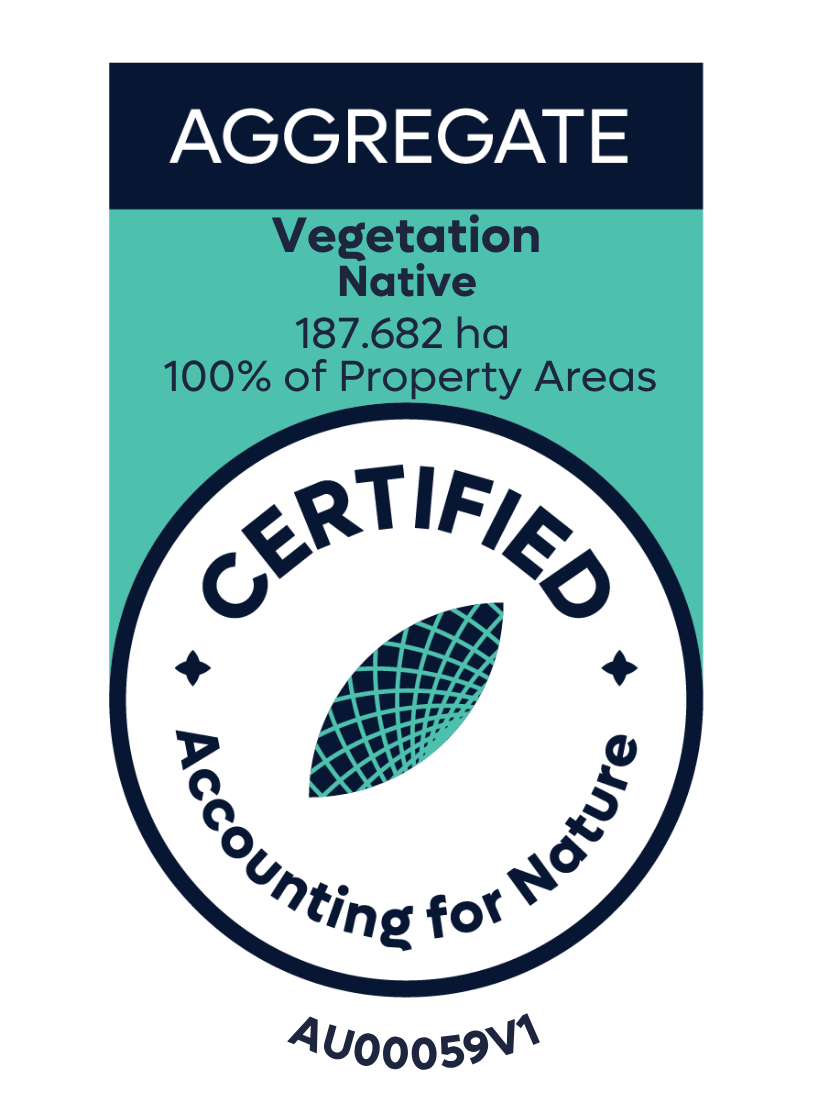

Environmental Asset Account Econd® summary.
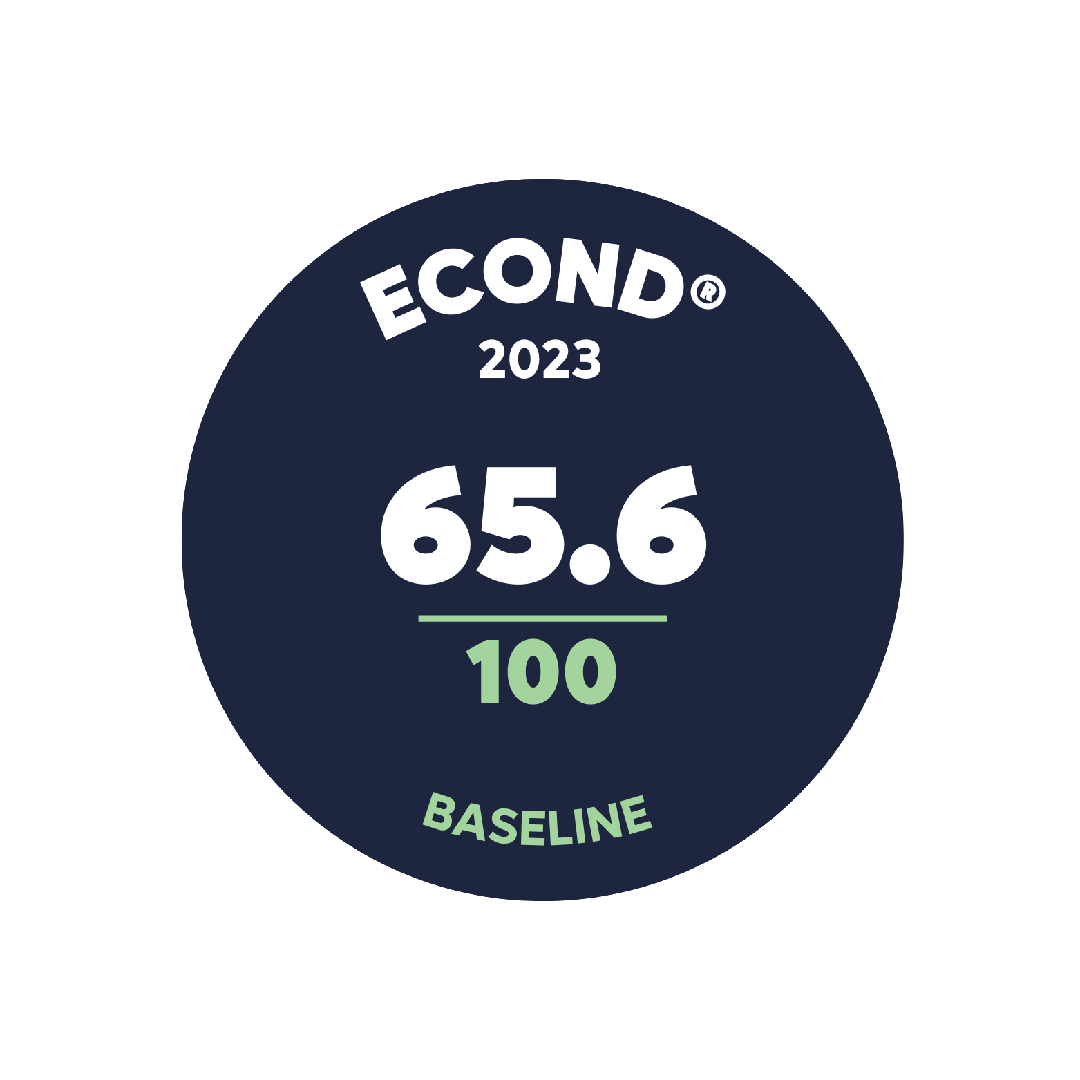
Environmental Asset Account statement.
-
16 August 2023 - Registration date
-
25 February 2025 - Certification date
-
14 September 2026 - Annual Certification Compliance Report (ACCR)
No significant event or material change in land use was reported or identified
Significant outcomes.
The properties within this account exhibited significant land modification; however, native vegetation communities were still present, with Weeping Myall communities identified as an important feature. A total of 38 unique plant community types (PCTs) were surveyed, of which 21 were associated with threatened ecological communities (TECs) listed in the NSW account. Mapping issues were observed for Seasonal Wetlands/Lakes in the area, where non remnant areas were either misidentified as TECs or mapped incorrectly. These findings highlight the limitations of vegetation maps. The Assessment unit Econd® revealed that Palatable Tussock Grasslands (non-remnant) had the lowest score at 35.2, while Mulga Species Shrublands had the highest score at 72.8. These results underscore the need to protect and maintain the remaining remnants of threatened communities and to improve the accuracy of vegetation mapping to support effective conservation efforts.
Limitations & disclosures.
Cryptogam was excluded from the account
The cryptogam indicator was excluded because there was no available benchmark for the chosen reference condition approach (i.e. published NSW BioNet benchmarks). The data was collected as part of the process to accurately reflect our efforts, based on the method used for data collection.
Native tree size structure was excluded from the account
The Bionet benchmark for native tree size structure is provided as the number of large trees (separated into eucalypt and non-eucalypt) per unit area. A method to calculate native tree size structure was derived which involved several steps to make the published benchmarks comparable with the drone observations of tree canopy size. In essence, this involved the conversion of DBH-based benchmarks to tree crown characteristic benchmarks that could be assessed with the drone-based data. However, significant uncertainty stemming from compounding errors in individual tree segmentation, allometry relating benchmark DBH to crown characteristics, and uncertainty / unknown errors in the eucalypt / non-eucalypt large tree benchmarks, remained in the results. Ultimately this level of uncertainty was unsatisfactory, and this indicator was excluded from the account. As more detailed benchmarks and individual tree segmentation/classification approaches are made available, this indicator can be revisited for follow-up accounts.
Classification accuracy and alternative classification approach
There were sites where low classification accuracy was reported which reduced the overall accuracy reported for the model at the property and account level. This was due to a combination of noise in high resolution data, the blurring of indicators around the edge of objects, occasional inaccuracy in the derived canopy height model, and model inaccuracies.
In sites where less than half of the validation points were accurate, a manual annotation approach was taken to calculate the proportion of cover of the relevant classes. For this, a 0.1-hectare sub-plot was generated at the centre of the orthomosaic in the cloud-based DroneDeploy platform. Then the cover of trees, shrubs, bare ground, and ground cover was digitised. The area of these classes was calculated and used to derive indicator values. More detail on the calculation of each indicator is provided in the association Excel workbook. The sites that were manually digitised were excluded from the validation process, which ensured that only sites reporting relatively high accuracy contributed to the account calculation.
All original data has been preserved to allow for re-processing upon the development and implementation of more advanced classification pipelines.
Coarse woody debris
The computer vision model applied to classify coarse woody debris was not sufficiently accurate to calculate this indicator. As an alternative, this indicator was calculated by digitising (using a line draw tool in Drone-Deploy) all of the visible coarse woody debris within 0.1-hectare sub-plots for each of the sites. The length of each of the lines was then summed, and multiplied by 10, to provide an estimate of the length of coarse woody debris per hectare. This indicator was directly comparable with the NSW BioNet benchmarks.
Revision of plot area
When greater than 10% of the area of the 5-hectare high-resolution remote sensing plot was comprised of an assessment unit other than the target assessment unit, only the target assessment unit was assessed. However, this clipping at times led to high resolution remote sensing plots that were less than 5-hectares. The final area of each high-resolution remote sensing plot for those plots that were re-analysed is available in the confidential supporting information. A total of 32 sites comprised less than 5-hectares of the target class, with four sites containing less than 1-hectare. Upon inspection, these target vegetation classes tended to be small and patchy, making the collection of 5-hectares of imagery challenging. Seventy-one sites containing more than 5 hectares of the target vegetation class were analysed for the drone matrix.
Last update: 02 September 2026


Environmental Account.
Learn more about this Environmental Account.